Universal Fit Product.
GARMIN VUS020R ST LAWRENCE SEAWAY BLUECHART G2 VIS
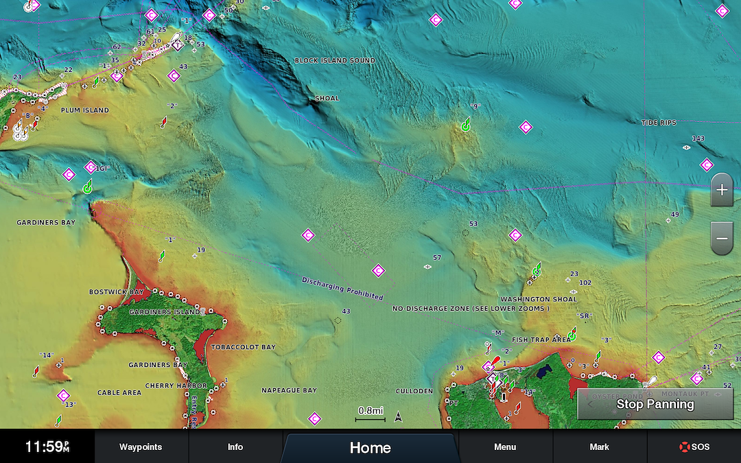
FROM THE MANUFACTURER The Garmin BlueChart g2 Vision SD Card, St.Lawrence Seaway offers the same rich detailed charting of BlueChart g2 to help you get the most out of your Garmin chartplotter. In addition, g2 Vision features a growing database of high-resolution satellite imagery, above and below the water 3D perspectives, auto guidance technology, aerial photographs for real world references and coastal roads with points of interest. The g2 Vision features high-resolution satellite imagery that, when overlaid on the chart, provides you with unparalleled situational awareness, and auto guidance technology that searches chart data to suggest the best passage to your destination. This unit also comes with aerial reference photography which provides real-world photos of ports, harbors, marinas, waterways, navigation landmarks and other points of interest, offering you another powerful tool for navigating unfamiliar waters. Garmin's BlueChart g2 sets a new standard in marine cartography with its MarinerÂ?s Eye View perspective providing a birdÂ?s eye view from behind the boat showing chart information for a quick, reliable and easy position fix, as well as Fish Eye View 3D perspective which provides an underwater view that visually represents the sea floor according to the chart's information. The g2 has fishing charts that allow you to hide navigation data from the SD card while leaving the bottom contours and depth soundings for your next fishing adventure, and includes tides, currents, marine services, coastal roads and points of interest. The BlueChart g2 SD Card, St.Lawrence Seaway provides coverage of the St. Lawrence River from Cape Vincent to Sept Iles, including: Montreal, Quebec, Lake Champlain to Glenn Falls, Burlington, VT, the Ottawa River to Temiscaming, Lac St. Jean, and the Hudson River to Troy, NY. This product is compatible with most of Garmin's new fixed-mount chartplotters, although user's should check the manufacturer's website to see a product compatibility table for the list of products that Garmin recommends with this software.What's in the BoxGarmin BlueChart g2 Vision SD card with maps of the St.Lawrence Seaway, and instruction pamphlet.


)
)