


)
)
FREE SHIPPING
IN CANADA
IN CANADA
90 DAYS RETURN
GUARANTEE
GUARANTEE
CANADIAN OWNED
IN ONTARIO
IN ONTARIO

STARTING FROM
CAD$ 207.92
On Sale ForCAD$ 207.92
Omnia Product Expert is nline !
FOUND A LOWER PRICE? We'll Beat Any Lower Price You Find!
Some Condition Applies*
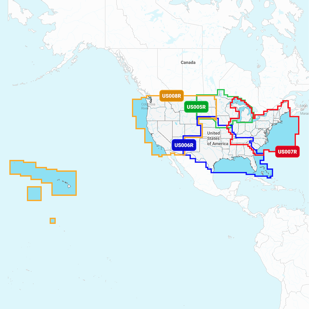
Garmin Navionics+ Marine Cartography 010-C1292-20 SKU Listing / Specs
| Purchase | Part Number | Image View | Name | Detail Specs | UPC |
|---|---|---|---|---|---|
|
SKU: 010-C1292-20
CAD$ 207.92
|
 Enlarged View |
Garmin Navionics+ Marine Cartography 010-C1292-20 INSTOCK: 4 LEFT!
INSTOCK: 4 LEFT! UpdatedOn: 10/5/2025 12:00:00 AM |
Universal Fit Product. Marine Cartography; NAVIONICS+; LiveScope And Panoptix Chart Plotters; Region Code: NSUS008R; Detailed Coverage Of West Inland and Coastal; On SD/Micro-SD Card Product Description Featuring vibrant colors, a streamlined interface and combined coastal and inland content with a popular Navionics ® style color palette, Garmin Navionics+ cartography makes it easy to plot your course with the world’s No. 1 name in marine mapping. The downloadable sonar imagery feature reveals bottom hardness clearly and in contrasting color, highlighting both subtle and dramatic transition areas on select U.S. lakes. Crystal-clear aerial and surface photos of ports, marinas, bridges, docks, boat ramps, dams and navigational landmarks provide a better sense of your surroundings above the waterline. This view provides a 3D representation of the surrounding area both above and below the waterline. Adjust your maps to the lake’s current water levels to see if spots are accessible or too shallow to explore. |
753759289867 |
Hot Product recommendation:


Marine Cartography; NAVIONICS+; LiveScope And Panoptix Chart Plotters; Region Code: NSUS008R; Detailed Coverage Of West Inland and Coastal; On SD/Micro-SD Card