


FREE SHIPPING
IN CANADA
IN CANADA
90 DAYS RETURN
GUARANTEE
GUARANTEE
CANADIAN OWNED
IN ONTARIO
IN ONTARIO

STARTING FROM
CAD$ 317.19
On Sale ForCAD$ 317.19
Omnia Product Expert is nline !
FOUND A LOWER PRICE? We'll Beat Any Lower Price You Find!
Some Condition Applies*
Garmin Navionics+ Marine Cartography 010-C1482-20 SKU Listing / Specs
| Purchase | Part Number | Image View | Name | Detail Specs | UPC |
|---|---|---|---|---|---|
|
SKU: 010-C1482-20
CAD$ 317.19
|
 Enlarged View |
Garmin Navionics+ Marine Cartography 010-C1482-20 INSTOCK: 4 LEFT!
INSTOCK: 4 LEFT! UpdatedOn: 10/5/2025 12:00:00 AM |
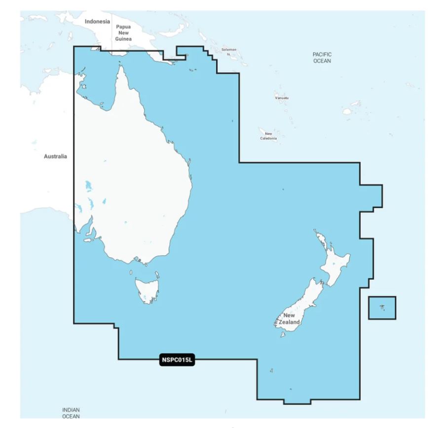
Universal Fit Product. Marine Cartography; NAVIONICS+; Region Code: NSPC015L; On SD/Micro-SD Card; One-Year Subscription Product Description Featuring vibrant colors, a streamlined interface and combined coastal/inland content with a popular Navionics® style color palette, Garmin Navionics+ cartography makes it easy to plot your course with the world’s No. 1 name in marine mapping. Access detail-rich mapping of coastal features, lakes, rivers and more. Integrated Garmin and Navionics® content offers coverage for boaters worldwide. Charts are constantly being enhanced with new and amended content: Thousands of updates are made every day. The one-year provided subscription gives you access to daily chart updates via the ActiveCaptain app. Combining the best of Garmin and Navionics automatic routing features, built-in Auto Guidance+ technology2 gives you a suggested dock-to-dock path to follow through channels, inlets, marina entrances and more. High-resolution depth range shading lets you select up to 10 color-shaded options and view your designated target depths at a glance. For improved fishing and navigation, up to 1 Feet contours provide a clear depiction of bottom structure for improved fishing charts and enhanced detail in swamps, canals, harbors, marinas and more. This detailed shading feature3 combines color and shadow to give you an easy-to-interpret, clearer view of bottom structure than contour lines alone. Crystal-clear aerial and surface photos of ports, marinas, bridges, docks, boat ramps, dams and navigational landmarks provide a better sense of your surroundings above the waterline. |
753759334833 |
Hot Product recommendation:


Marine Cartography; NAVIONICS+; Region Code: NSPC015L; On SD/Micro-SD Card; One-Year Subscription